Assessment of Changing Land-Use Practices on Basin Sediment Yields and Provenance in Western North Carolina Using Multivariate Fingerprinting Techniques
![]()
![]()
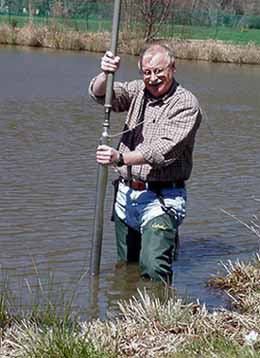
Sediment Generation and Transport
![]()
![]()
![]()
Project Overview
The ecological and financial impacts of sediment on streams and rivers of the southern Appalachians has become a significant issue in the past decade. It is generally assumed that most of this sediment is the result of land-use alterations, particularly those associated with development activities. In fact, federal, state, and local agencies have stated that anthropogenically derived sediment (i.e., sediment resulting from human activities) is the most serious non-point source pollutant in the mountainous terrain of western North Carolina. Unfortunately, however, there have been few attempts to actually quantify the impacts of land-use alterations on upland erosion in the southern Appalachians. This investigation examines the use of physical and geochemical fingerprinting techniques and sediment mixing models within the Fairfield Lake basin to determine if they can be effectively utilized in the steep terrain of western North Carolina. More specifically, the study attempts to determine the relative contributions of sediment, at any given time, to Fairfield Lake from specific geologic units and delineated land-cover types (e.g., forests, roads, lawns, etc.). To our knowledge, this is the first attempt to apply these procedures in the southern Appalachians.
Investigators
Jerry R. Miller, Department of Geosciences and Natural Resources Management, Western Carolina University
Mark Lord, Department of Geosciences and Natural Resources Management, Western Carolina University
Lawrence Kolenbrander, Department of Geosciences and Natural Resources Management, Western Carolina University
Steven Yurkovich, Department of Geosciences and Natural Resources Management, Western Carolina University
Gail Mackin, Department of Mathematics & Computer Science, Northern Kentucky University, Highland Heights, KY 41099
Funding
-
North Carolina Water Resources Research Institute
Preliminary Findings
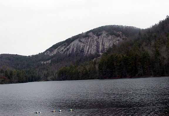
Sedimentation within Fairfield Lake has been limited since dam closure in 1890. Most of the sediment that enters the lake is deposited near the mouth of tributaries creating deposits on the order of 50 to 100 cm in thickness. Deep-water areas located along the axis of the reservoir, and which are removed from the direct influx of tributary sediment, have received only a limited amount of debris (generally <30 cm). 210Pb data clearly indicate that sedimentation rates have significantly increased during the past few decades. The most significant increases occur in the mid-1980s and the late 1990s, both of which correspond to periods of development documented by the comparison of aerial photographs obtained in 1963, 1975, 1988, and 2000. The more recent sedimentation rates are several fold greater than the rates observed during the first half of the 1900s. If the current rates of sedimentation continue into the future, sediment accumulation will likely lead to ecological impacts within the lacustrine system and cause problems for those utilizing the lake for recreational activities.
The statistical treatment of geochemical data from sediments overlying the Whiteside Granite and the Tallulah Falls Formation suggest that the soils associated with these lithologies can be delineated on the bases of Cu, Mn, Sn, U, and Zn. That is, the bedrock units exhibit a unique geochemical fingerprint defined by these five parameters. Similarly, materials from differing sediment sources within the Whiteside Granite, including forests, roads, lawns, and alluvial deposits along upland streams can be defined on the basis of Ag, Bi, Cr, Mn, Mo, Ni, Sb, Sn, and Zn. Thus, the results from the linear discriminant analysis suggest that it is possible to use sediment mixing models to determine the quantity of material derived from differing lithologies or land-cover types.
In light of the above, a separate sediment mixing model was developed using the parameters defined in the discriminant analysis to (1) assess the relative contributions of sediment derived from the different bedrock units that underlie the watershed, and (2) define the contributions of materials to the lake from the four different upland sediment sources. With respect to differentiating between bedrock sources, the model worked reasonably well. However, it appears to have been unable to distinguish between sediment derived from the Tallulah Falls Formation and sediment from a micaeous, more mafic-rich unit of the Whiteside Granite. These two units apparently have a similar geochemical fingerprint. This problem may be addressed by using one of two different approaches. First, the micaeous unit of the Whiteside Granite can be treated as a separate sediment source. Thus, in this study, the mixing models would examine the contributions of material from three lithologic units. For small watersheds, such as the Fairfield Lake basin, this approach may work well. However, for larger watersheds, the approach may lead to an unmanageable number of different sediment sources. An alternative approach is to define sediment sources according to the gross mineralogical composition of the rocks. In this case, sediments from the Tallulah Falls Formation and the micaeous unit of the Whiteside Granite would be treated as a single source type. There is some merit to this approach in that previous studies have shown that rock units of similar composition also function similarly in terms of their erodibility. Model output may then lead to a conclusion that sediment from a particular lithologic (mineralogic) group tends to produce most of the sediment in an area and, therefore, these rock units should be treated differently (perhaps more stringently) in terms of management practices.
The modeling of the relative contributions of sediment from forests, lawns, roads, and upland alluvium also shows promise in that the model was able to define systematic changes in core geochemistry that are related to changing sediment sources documented on aerial photography. However, it appears that the geochemical signal of lawns, roads, and forests may be muted by geochemical processes as the sediments are transported through upland streams to depositional sites within the lake. Thus, the approach will require modification before it can be effectively used in western North Carolina. Specific modifications should focus on (1) the use of elemental ratios as geochemical fingerprints, and (2) the use of weighting factors based on the ratios of more soluble to less soluble constituents (e.g., Ti) to reduce the effects of elemental loss on the mixing model results.
Publications
Miller, Kolenbrander, Lord, Mackin, and Yurkovich, in review, Assessment of Changing Land-Use Practices on Basin Sediment Yields and Provenance in Western North Carolina Using Multivariate Fingerprinting Techniques, WRRI Project Report.
Lord, Mark L., Miller, Jerry R., Yurkovich, Steve P., Kolenbrander, Larry G., Mackin, Gail, 2001. Assessment of changing land-use practices on basin sediment yields and provenance in western North Carolina using multivariate fingerprinting techniques. Geological Society of America Abstracts with Programs, v. 33.
Miller, Jerry R., Lord, Mark L., Yurkovich, Steve P., Kolenbrander, Larry G., and Mackin, Gail. 2002. Can geochemical fingerprinting be used to determine the relative contributions of sediment through time from different source areas? - A pilot study in the southern Appalachians, North Carolina. Proceedings, WRRI 2002 Annual Conference, Setting the Agenda for Water Resources Research, Raleigh.