HEAVY METALTRANSPORT AND FATE IN AQUATIC ENVIRONMENTS

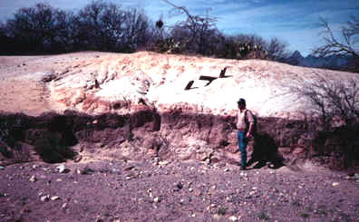
Mine Tailings,
Arivaca, Arizona
Heavy
Metal Projects
Rio
Pilcomoyo,Bolivia|Guyana
|Geochemical
Fingerprinting
___________________________________________________
Sediment Generation and Transport
It is not uncommon for 90 % or more of the total heavy metal load in polluted rivers to be transported in the particulate phase. During transport, sediment-bound metals are removed from the water column and stored in alluvial deposits for years, centuries, or even millenia before they are reintroduced to the aquatic environment. My colleagues and I have been using a geochemical-geomorphological approach to gain a better understanding of the mechanisms through which heavy metals and other contaminants are transported, stored, and remobilized within fluvial environments over various temporal and spatial scales, particularly large river systems in South America. Specific topics of interest including the following:
(1) The development of cost effective procedures to determine the spatial distribution of sediment-bound contaminants in alluvial deposits.
The underlying premise of these investigations is that pollutant concentrations vary as a function of the local depositional processes. Thus, pollutant concentrations can be linked to specific depositional units and facies, allowing first order approximations of contaminant concentrations to be determined by the delineation and mapping of alluvial stratigraphic deposits. Of particular interest in these studies is the identification and characterization of geomorphic processes involved in the partitioning of heavy metals into discrete depositional units in arid, temperate, and humid tropical environents.
(2) The utilization of spatial patterns in heavy metal concentrations in floodplain, terrace, and channel bed deposits to elucidate the dynamics and history of sediment transport within fluvial systems. A relatively new field that combines alluvial stratigraphy and geochemistry is called chemostratigraphy. The basic idea is the chemical composition of alluvial stratigraphic deposits will vary, depending in part on the influx of the heavy metals from contaminant source areas. We are examining the methods through which these variations can be used to gain a better understanding of the long-term (decadal scale) sediment transport dynamics in river systems.
(3) The geochemical "fingerprinting" of stratigraphic deposits in order to determine source areas of alluvial sediments and the variations in source areas through time. In the southern Appalachians, these techniques are being used to assess the impacts of land-use changes on hillslope erosion and sediment yields within watersheds that exhibit steep slopes and highly erodible sediments. In South America (as well as in the southeastern U.S.) we are using lead isotopes to fingerprint specific contaminant sources, a process that allows us to track the contaminated sediments through fluvial systems.
