Assessment of Secondary Succession in North Carolina: advancing understanding of successional vegetation through coupled field and remote sensing studies
PROJECT OVERVIEW
Secondary successional ecosystems are widespread across the southeastern US and, as a whole,
comprise a substantial terrestrial sink for atmospheric carbon dioxide. However, the transient nature
of vegetation structure and function along successional trajectories means that the magnitude of this
sink is unsteady through time. Many studies have shown the temporal variability of carbon
sequestration by successional ecosystems in this region; however, considerable uncertainty remains
concerning the spatial distribution of these ecosystems, spatial trends in trajectories of successional
vegetation, and sensitivity of successional vegetation, trajectories and carbon dynamics to climate
variability. A clear understanding of these factors is necessary to predict future carbon sequestration
and other ecological processes within this region. A unique opportunity exists to address these and
other uncertainties and to improve understanding of secondary succession in this region using high resolution
lidar (light detection and ranging) data that were collected over the entire state of North
Carolina between 2001 and 2005. This dataset was originally intended for mapping ground
elevations and floodplain boundaries across the state, but recent work has demonstrated that
important information on vegetation structure and distribution remains embedded in the data.
The principle objective of the project is to enhance current understanding of the status of and
controls on successional ecosystems in the southeastern US through development and analysis of
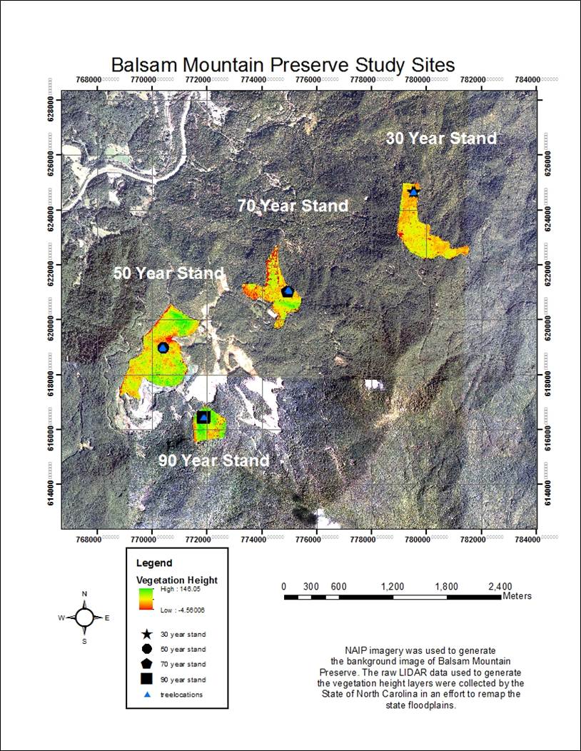
coupled remotely sensed and ground based datasets. The project will generate high-resolution (6.1 m)
maps of vegetation heights for five successional landscapes in North Carolina of approximately
1,000 km2 each. The five sites will be located in different physiographic provinces of the state, and
vegetation height maps will be combined with ground-based and additional remotely sensed data
from each site to assess controls on the heterogeneity of successional stands and successional
chronosequences, and on their associated carbon dynamics (primarily gross primary productivity and
net primary productivity). The project will examine processes at individual field sites and also
among field sites to better understand how successional characteristics vary across the region.
Project Student Recruitment
RESULTS
PRESENTATIONS
April 2011. Association of Southeastern Biologists - 72nd Annual Meeting. Huntsville, AL. “Analysis of secondary forest succession using LIDAR analysis in the southern Appalachians” B.D. Kloeppel, R.G. Kreza, M.C. Mentzer, T.J. Souther, and R.E. Emanuel. Poster.
August 2011. Ecological Society of America - 96th Annual Meeting, Austin, TX. “Secondary forest succession quantification using LIDAR analysis in the southern Appalachians” T.J. Souther, R.G. Kreza, M.C. Mentzer, B.D. Kloeppel, and R.E. Emanuel. Poster.
August 2011. Ecological Society of America - 96th Annual Meeting, Austin, TX. "Cross-site synthesis LIDAR Project" R.E. Emanuel, Z.E. Barthel, J. Jackson, M. Jackson, J. Johnson, R.G. Kreza, M.C. Mentzer, E. Mutai, D.A. Smith, T.J. Souther, R. Sue, C.J. Sutton, M. Talley, A. West, J. Fail, Jr., L.S. Jernigan, B.D. Kloeppel, and S. Sabaratnam.. Poster.
November 2012. Southeastern Division of the Association of American Geographers - 67th Annual Meeting. Asheville, NC. “Secondary forest succession quantification using LIDAR analysis in the southern Appalachians” M.C. Mentzer, B.D. Kloeppel, R.G. Kreza, T.J. Souther, and R.E. Emanuel. Poster.
PUBLICATIONS
in preparation. 2013. "Tree height as an ecological response to climate" R.E. Emanuel, B.D. Kloeppel, L.S. Jernigan, and S. Sabaratnam. Target journal: BioScience or Frontiers in Ecology and the Environment.
ACKNOWLEDGEMENTS
We acknowledge funding from National Science Foundation grant DEB-1110742 to support this project. We thank Balsam Mountain Preserve for allowing us to conduct research on their property.
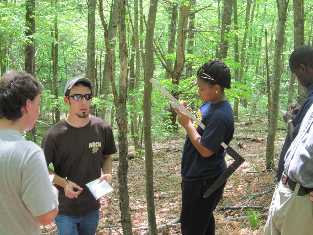
Western Carolina University student researchers (left to right):
T.J. Souther (B.S. 2011), Robbie Kreza (B.S. 2011), and Marcus Mentzer (B.S. 2013) |