Project Overview
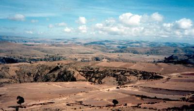
The Rio Pilcomayo heads on the Cerro Rico de Potosí precious metal-polymetallic tin deposits of Bolivia. From here, it flows nearly 670 km downstream to the Argentine border (Fig. 1) where it enters the Chaco Plains, a 210,000 square kilometer, low-declivity, fan-shaped body of sediment that merges with four other fan complexes created by the Rio Salado, the Rio Bermejo, the Rio Parapetí and the Rio Grande. Cerro Rico is dominated by mineralized hydrothermal veins that are generally 10-50 cm thick, but may be up to 200 cm thick. One of the first silver mines in the New World (La Descubridora) was opened on April 1, 1545, by a Spanish captain - Diego de Zenteno - at Cerro Rico in the Potosi Mining District (Garcia-Guinea, 1995). By 1572, more than 150 mills had been built in the area to process the ores, and the silver produced change both the economy of the Peruvian Viceroyalty as well as the economic structure of Europe (Garcia-Guinea, 1995).
Mining began with the exploitation of the very rich (4.25-25.5%) silver ores in the upper part of the mountain. Following exhaustion of these rich ores in 1572-1573, Ag was extracted using Hg amalgam processes. Amalgamation ceased around 1900. In 1952, the government privatized all major mines under the Corporación Minera de Bolivia and tin mining began to dominate mining operations. Falling tin prices in 1985 led to a shift in mining from tin-silver ores to zinc-silver ores. Also of significance, ore extraction changed to a froth flotation process which continues to be used today. Currently, the primary source of heavy metals to the Rio Pilcomayo are the 30 to 40 ingenios (mills) that release floatation effluent and tailings materials directly into local rivers in the Potosí area (particularly Rio de La Ribera). The current release of contaminants to the Rio Pilcomayo is obvious as a number of processing facilities near Potosi are releasing effluent rich in pyrite and metals directly into its tributaries. The advent and use of the Patio mercury (Hg) amalgamation process suggests that contamination during colonial times may also have been significant. It is estimated that 1.5 kg of Hg were lost to the environment for every kg of silver that was produced using the Patio Process (Garcia-Guinea, 1995; Nriagu, 1994). An examination of silver export statistics shows that the loss of Hg to the Pilcomayo basin may have reached more than several hundred tons per year between 1520 and 1820 (Nriagu, 1993).
Contamination of water, sediments, and soils is not limited to the main stem of the Rio Pilcomayo, but occurrs within many of its tributaries as well, including the Rio Tupiza, the Rio Tumuzla, and the Pilaya. Contamination in the Rio Tupiza and Rio Tumuzla drainages is partly related to the failure of mine/mill tailings faculities at Abaroa and Porco, respectively. However, the relative significance of these events in comparison to contamination from historic mining operations is still unclear.
In 1998, an international and interdisciplinary research team initiated a geomorphic-geochemical investigation of the Pilcomayo basin. Our initial goals were to gain a working knowledge of the Rio Pilcomayo's geomorphic setting and to obtain a preliminary understanding of water, sediment and soil geochemistry within the basin. Results from these earlier investigations have been published in several professional journals (see articles by clicking here) and led to a number of additional, ongoing investigations including:
(1) the use of lead-isotopic fingerprinting techniques to quantify the downstream movement of mill tailings materials from the mines at Potosi into and through the Rio Pilocomayo;
(2) the assessment of the degree of contamination of soils and irrigation waters within agricultural fields located within selected communities along the Rio Pilcomayo;
(3) the assessment of metal exposure in humans through the analysis of urine and hair; and
(4) the preliminary assessment of the impacts of the 2003 Abaroa Milling tailings dam "failure" on the water and sediment quality of the Rio Tupiza.
Our earlier studies demonstrated that the movement of metal contaminated sediments within the river systems is strongly dependent on geomorphological (erosional and depositional) processes operating the basins. Thus, inherent in the above investigations is an analysis of the geomorphic history of the Rio Pilcomayo and its tributaries. In addition to the main stem of the Rio Pilcomayo, these studies have focused on the Rio Tarapaya and the Rio Tarabuco.
Cited References in Text
Garcia-Guinea, J., 1995. Cerro Rico in-mine museum project, Potosi, Bolivia. Minerals Industry International, p. 13-18.
Nriagu. J.O., 1994. Mercury pollution from past mining of gold and silver in the Americas. The Science of the Total Environment, v. 149, p. 167-181.
Quevillon, M., Gibb, C., and Dogterom, J., 1995. The Rio Pilcomayo: An assessment of metal contamination in the fish rochilodus Platensis (Sabalo), a primary food staple of the Guarani, Itika Guasu. Report by the Queen's Project on International Development.